if there is one place i really really really REALLY want to go in Singapore, that would be Pulau Sekudu.
or Frog's Island.The name came from a pretty erm, well.. strange legend of how Pulau Ubin was formed.
Apparently, one fine day, a pig, an elephant and a frog decide to engage in a swimming race to johor (i never knew that elephants and pigs can swim!). all 3 animals lost, and the frog turned into Pulau Sekudu, and the elephant + pig turned into Pulau Ubin.
okay that aside, Frog's Island is really a small, Granite islet next to Chek Jawa:

look at those rocks: the colors, the shape and the placings of the rocks - these arent random! they are carved out after millions of years of weathering.
 Dont the rocks look like Chocolate truffle cakes? i believe that the white band is there as during high tide, the sea water covers that particular area, and wave action bleaches it (due to the salt content).. any thoughts?
what exactly is weathering?
in simple terms, its really the disintegration of rocks via natural elements such as water and heat from the sun.
Weathering and Erosion are different in a sense that Erosional processes MOVE materials away from their original spots and weathering does not do that.
i wldnt go into the ghastly details, though i would love to, you'd have to take A-Level geography for that!
I havent been onto the islet YET, as from what ive read, the NParks has made it now illegal to go onto the islet without a permit. For people have been abusing the islet by illegally fishing and harvesting marine life like oysters and clams. good going folks.
anyways, to give you an idea of how the rocks are like on the islet:
 (source: Wildsingapore)
these rocks arent here to stay forever, eventually the elements will weather it away into nothing. so it would be good to take a look before they are really gone.
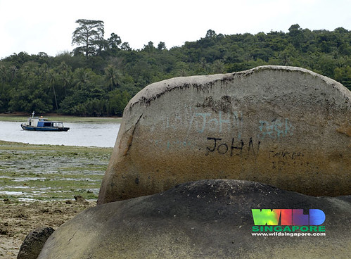 I understand the desire to leave your mark (for i was once an avid doodler on school tables), but OMG DONT PEOPLE GROW OUT OF IT? if you enjoy doodling, do it on a piece of paper.
(and john im sorry it says john, im sure its not you)
you can visit http://www.simplygreen.com.sg/ubin/frogisle.htm for some REALLY GOOD PICTURES. i was totally blown away.
This rock is found on the main island of P.Ubin:

the vertical lines are really lines of weakness which would allow the entry of water for further weathering.

 this is an example of how wave actions and water weather rocks and give them distinctive shapes (once again, ignore the two mad people)- if the rocks were bigger and the waves were stronger, the curved area would have formed a lagoon.
 ARRRGHHH! even the rocks arent spared of litter!!!
i know many people do not understand my obsession with rocks.
but if you think about it, rocks are really little bits of historical records of the changes that earth went through, take for example this:
 (photo: Vithya)
this is something my friend Vithya saw in India, its termed "Krishna's butterball" - a granite rock perched on a smooth slope. yet it doesnt roll! isnt it a wonder?
no one has any idea how it got there, for its composition is totally different from the other rocks around it. some suggested that it is brought there by Glacial Erosion - which has the capcity to move huge materials. but that would mean that india had a totally diffferent climate in the past! see what i mean now?

 (photo: John)
and these are some limestone/chalk cliffs that John visited in Dover, England. these cliffs, too, take millions of years before they become cliffs.
so the next time you kick a stone out of your way, remember, you are really kicking bits of Earth's history!
<3 serene!


